
Blue Spring
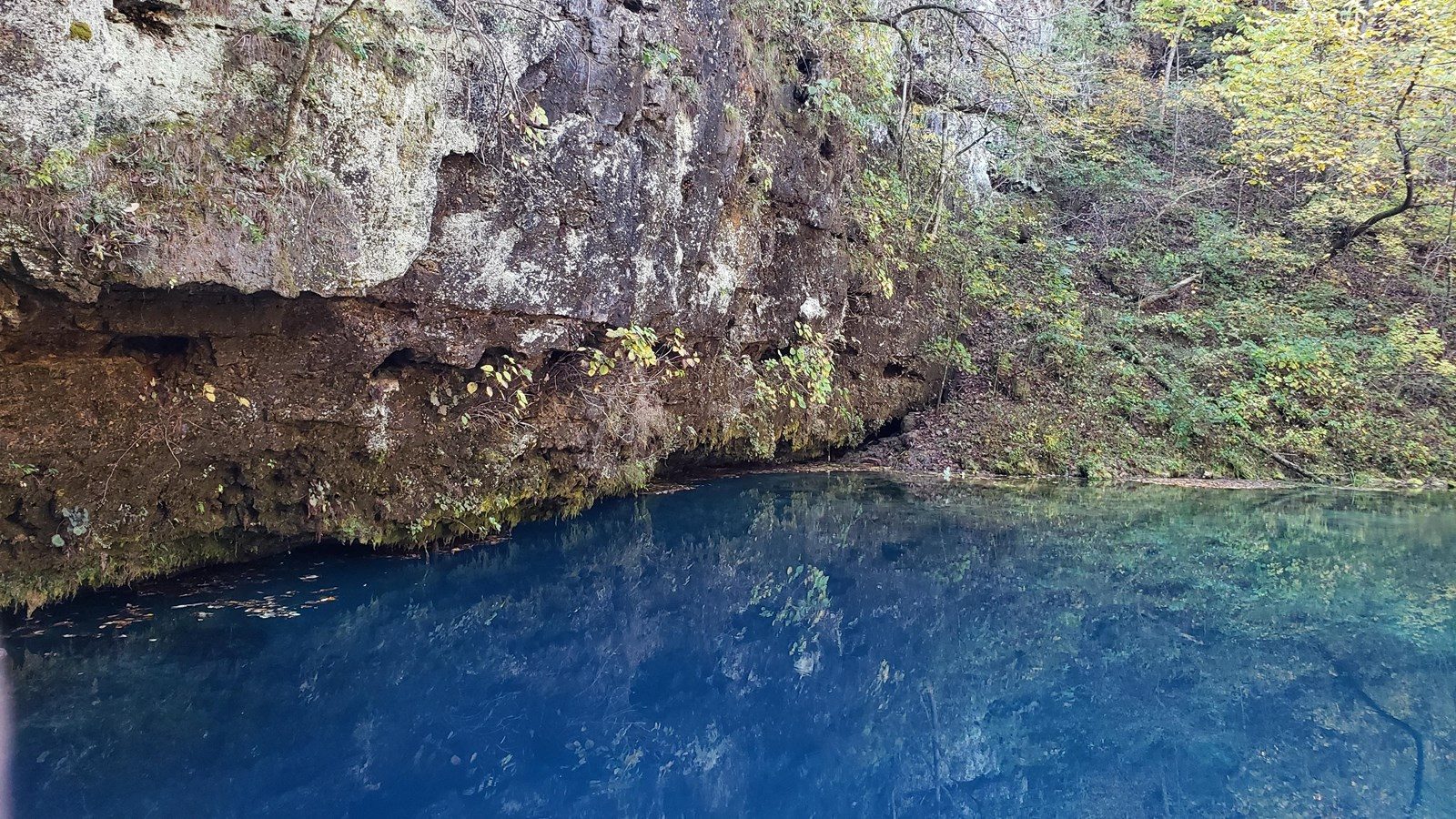
The deepest spring in Missouri rises cobalt blue under a bluff on the Current River, filling a look-but-don't-touch pool inside a state natural area.
Get directionsOpen in Google Maps
Blue Spring earns its name the moment you see it: water rising from a shaft more than 300 feet deep (the Park Service's place page puts the figure at 310) turns the pool an unreal cobalt under its sheltering bluff. It is the deepest spring yet measured in Missouri and the sixth largest in the state, sending roughly 90 million gallons a day down a short branch into the Current River.
The spring sits inside a 17-acre Missouri Natural Area designated in 1972. The Department of Conservation owns the spring and runs the natural area, while the Park Service administers the surrounding Riverways land and the river itself, a split both agencies state plainly on their own pages. Because the place is fragile, the rules are strict: no swimming, wading, boating, or fishing in the spring or its branch. Come to look, to photograph, and to picnic at the trailhead instead.
Getting there is part of the visit. From Highway 106, between Eminence and Ellington, a steep gravel road (County Road 106-535) drops roughly two and a half to three miles to a parking area, and a trail of about a quarter mile finishes the trip; the Park Service says large RVs and buses should not attempt the road. Hikers can also walk in about a mile and a half from Powder Mill Campground.
Good to know before you go
- Fees
- No fee is stated by MDC or NPS for the spring or the natural area. No entrance pass is required anywhere in Ozark National Scenic Riverways.
- Hours and seasons
- No seasonal closure or hours are stated by MDC or NPS; MDC lists the natural area as open to the public.
- Parking
- Parking area at the end of County Road 106-535, a long, steep dirt and gravel road of about 2.5 to 3 miles off Highway 106 (14 miles east of Eminence or 14 miles west of Ellington). NPS advises the road is not recommended for large RVs or buses; a passenger car can make it in most weather. A trail of about a quarter mile runs from the parking area to the spring.
- Accessibility
- No accessibility statement is published for this site; the approach is a steep gravel road and the spring is reached on foot by a trail of about a quarter mile.
- Nearest town
- Eminence, Missouri
- Region
- Southeast Missouri
- Coordinates
- 37.166006, -91.163223
What you can do there
- Picnic table
- Vault toilet
- Information kiosk
- Parking area